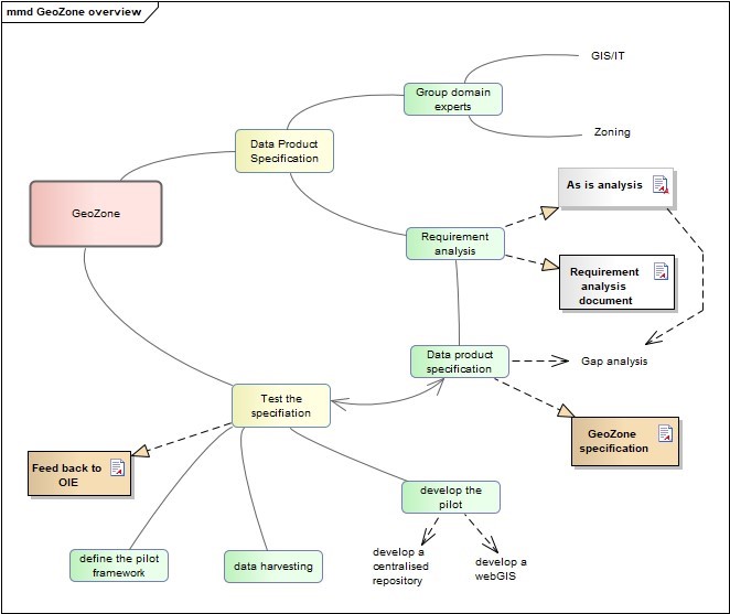
The GeoZone project aims to enable an exchange of geospatial data between National and International systems, through the creation of a Data Product Specification, a document with precise technical requirements to represent a zone from geographical point of view and the Techcnical Guidance, a document that provides technical guidaline to assist Members in managing, transferring and acquiring zone geospatial data.